
Storm Boelo: Flood warnings issued across Wales
NRW issues four flood warnings as Storm Boelo brings heavy rain and strong winds, disrupting transport and posing risks to coastal areas.
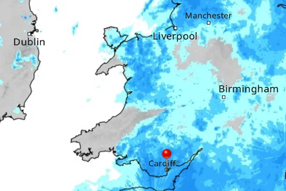
Four flood warnings have been issued across Wales as Storm Boelo descends, bringing heavy rainfall and strong winds that threaten significant disruption. Natural Resources Wales (NRW) has urged residents in affected areas to take immediate protective action as water levels rise rapidly. The severe weather system is impacting multiple river catchments, with specific dangers identified in the south and west of the country.
The most critical warnings are in place for the River Rhondda at Porth, the River Ely at Talbot Green and Peterston-super-Ely, and the River Towy at Llanwrda. At Talbot Green, NRW confirmed that river levels are rising, with flooding to property now expected. Flooding of low-lying land and roads was already ongoing, with heavy rainfall forecast to continue until approximately 9pm on Saturday.
The warning for Porth was issued at 5.35pm on Saturday, following earlier alerts for the other three locations in the afternoon. Dozens of lower-level flood alerts are also active across the country, indicating that flooding is possible and residents should be prepared. These alerts cover major river catchments including the Severn and Wye in Powys, as well as the Dyfi, Conwy, Teifi and Towy.
NRW advises people in flood warning areas to move family members, pets, and valuables to safety immediately. Residents are also urged to put flood protection equipment in place where it is safe to do so. Authorities have strongly warned the public to avoid walking, cycling, or driving through floodwater, as even shallow moving water can be dangerous.
A Met Office yellow warning for heavy rain covers Wales and parts of western and southern England until 11pm on Saturday. Coastal alerts stretch from parts of Pembrokeshire, Carmarthenshire, and Ceredigion to Swansea Bay, Gower, the Llŷn Peninsula, west Anglesey, and the north-east Wales coast. These warnings highlight the risk of coastal flooding and rough seas affecting maritime activities.
Transport networks have already begun to feel the impact of the storm, with ferries crossing the Irish Sea cancelled or disrupted. Rail passengers travelling further north also face restrictions due to the severe conditions. Avanti West Coast has strongly advised passengers not to travel north of Preston on Sunday, citing safety concerns related to the weather.
Met Office meteorologist Alex Burkill stated: “Storm Boelo is arriving.” It’s going to bring widespread rain and some very strong winds indeed, and it’s quick on the tails of Storm Austen which is now clearing away towards the east. He warned that heavy rain in western areas could cause flooding and significant spray on roads, increasing the risk of accidents for motorists.
Most areas are expected to become drier on Saturday evening after a burst of heavy showers, with only occasional light showers remaining overnight. However, a very windy night is anticipated, with occasional gales inland and stronger winds along coasts and over exposed high ground. Temperatures are forecast to fall to around 8°C during the night, adding to the challenging conditions for residents.
Sunday will bring sunny intervals and the possibility of a light morning shower, but strong and potentially disruptive winds are forecast to continue through the day. These winds are expected to ease towards the evening, offering some respite from the storm conditions. Temperatures are set to reach around 13°C, providing a slightly milder day despite the persistent wind.
The unsettled weather pattern is expected to persist, with heavy rain forecast to return to Wales on Monday, followed by strong winds and coastal gales. Tuesday is expected to be windier still, although brighter spells and scattered showers are predicted. Wednesday should bring bright and breezy conditions with isolated showers, marking a gradual improvement in the weather outlook.
The strongest winds are expected across parts of Scotland, northern England, and Northern Ireland, where amber warnings are in place and gusts could exceed 80mph. Storm Boelo follows Storm Austen, which left thousands of homes in south-west England without power after hitting the region on Friday. The rapid succession of storms highlights the volatile nature of the current atmospheric conditions affecting the UK.
For the latest updates on flood warnings and alerts, the public is advised to check the Natural Resources Wales website. Those in affected areas can also call Floodline on 0345 988 1188 for specific information regarding their location. Staying informed is crucial for ensuring personal safety and protecting property during this period of severe weather.